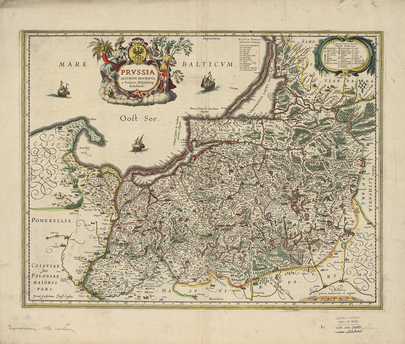
Maps in the Low Countries
Cartographic Predecessors
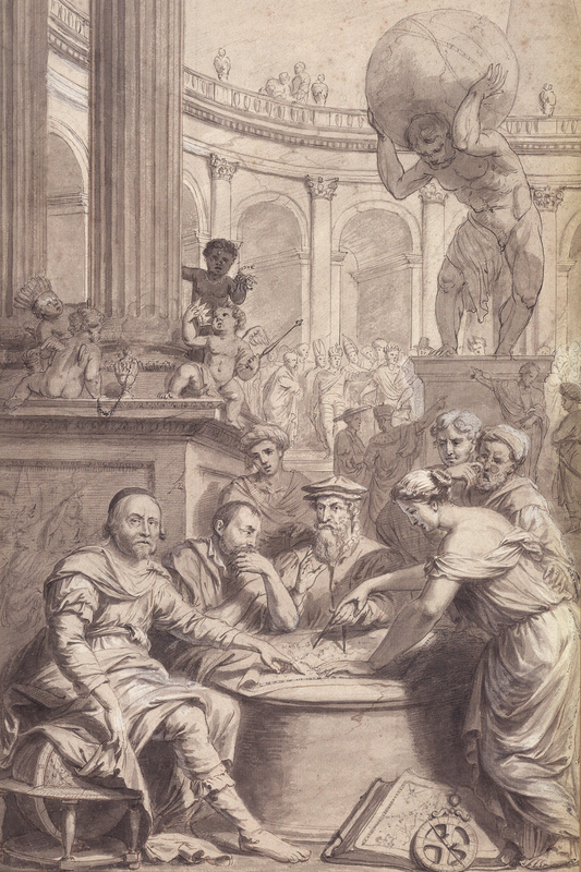
While the work of Hondius, Janssonius, and Blaeu is still widely celebrated, it is helpful to look back at the mapmakers and maps that inspired and influenced them. The antecedents of the Hondius and Janssonius maps can be traced back to the portolan (sea navigation) charts, Ptolemaic maps, and local property and legal maps. During the early part of the 15th century, little was known of the world outside of Northern Europe. However, two factors profoundly changed this: the return of the Portuguese voyages of discovery and the reappearance of Claudius Ptolemy’s Geographia.
Originally published in Egypt by Claudius Ptolemy (100-170 C.E.), Geographia was first translated into Latin in 1406. It revolutionized cartography, allowing cartographers to create atlases with a geographical accuracy previously unknown. The Ptolemaic portrayal of the world was soon supplanted by the influx of new geographic information from the maritime explorations of coastal Africa, South and East Asia, and the Americas. With this new knowledge, atlases evolved into more accurate and standardized publications. In 1570 Abraham Ortelius published what many consider to be the first modern atlas, the Theatrum Orbis Terrarum (Theatre of the World).
Abraham Ortelius (1527-1598) began as a map colorist and eventually became a book, print, and map seller. Throughout his travels and business dealings, Ortelius made connections with mapmakers across Europe, many of whom provided maps for his Theatrum. Ortelius redrew these maps, in order to have a uniform style and size throughout his work. (Koeman, 319). The Theatrum, published in several languages, was not only the most expensive printed book, but also the most popular atlas of its day.
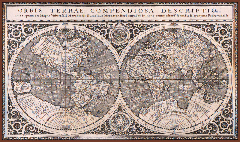
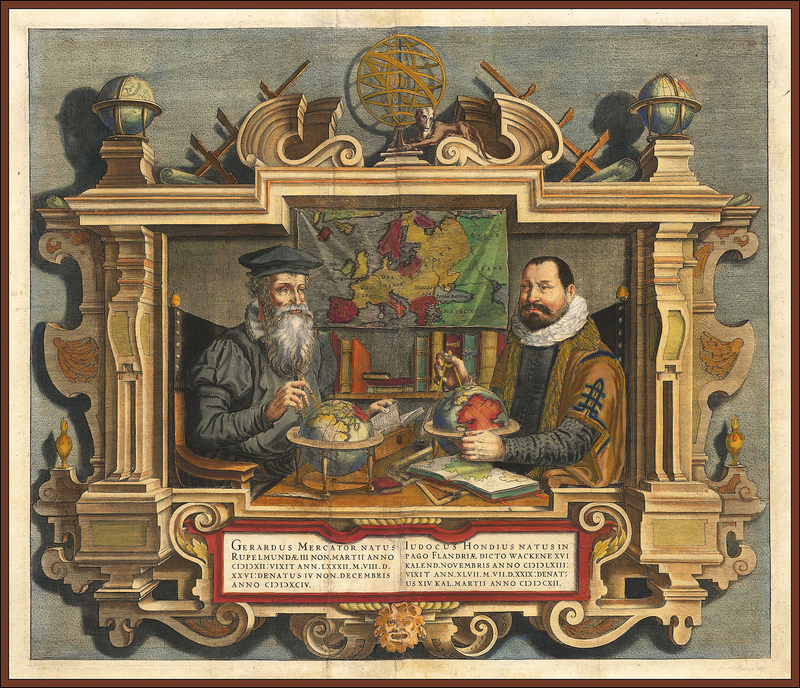
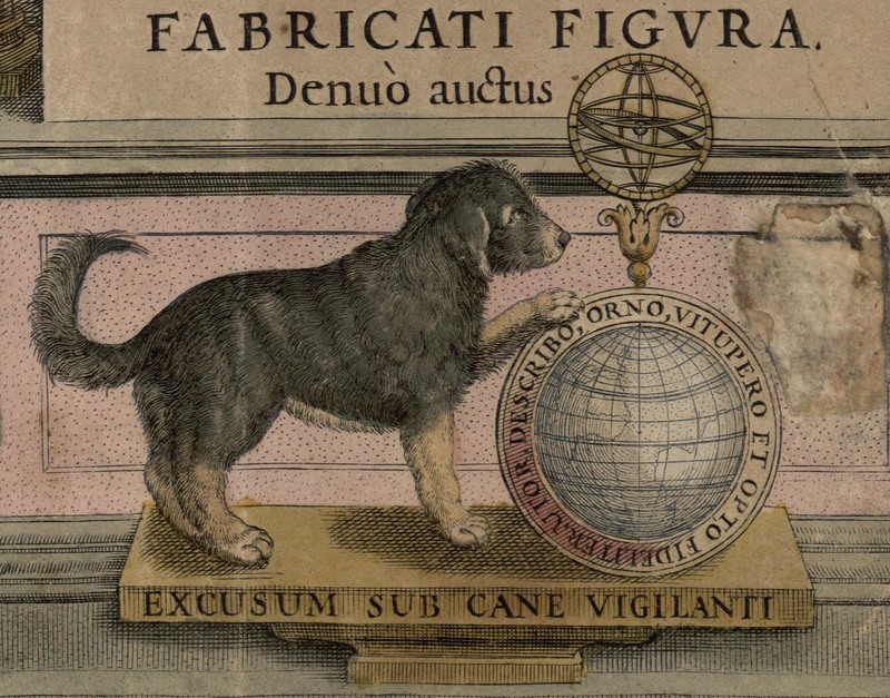
Gerhard Mercator (1512-1594), a close and influential friend of Ortelius, was a mathematician, globe and instrument maker, geographer, cartographer, and cosmographer. Mercator studied at the University of Leuven, under Gemma Frisius, an important mathematician and globe and instrument maker. It was through Frisius that Mercator became the most respected globe maker of his day. In the 1560’s Mercator began work on his famed atlas, which would shape the future of Dutch cartography. Mercator’s son Rumold (ca. 1545-1599) consolidated the maps and published the full edition of the Atlas sive Cosmographica Meditationes de Fabrica Mundi et Fabricati Figura (Atlas, or Cosmographic Meditations on the Fabric of the World and the Figure of the Fabrick'd) in 1595, one year after Gerhard’s death (Koeman, p.1323).
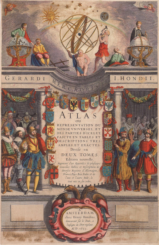
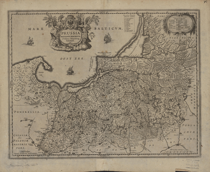
In 1604 Mercator’s grandson sold the copper plates to Cornelis Claesz. (1560-1609), a Dutch printer, publisher, and bookseller. Together with Jodocus Hondius Sr. (1563-1612), Claesz. published an updated version of the Atlas in 1606. It contained 37 new maps by various authors, including several engraved by Hondius himself. Even after Claesz’s death in 1609, Hondius continued to publish the Atlas until his own death in 1612. The 16 plates were passed to Hondius’s sons, Jodocus Jr. (1595-1629) and Henricus (1597-1651), and eventually Johannes Janssonius (1588-1664). They reused and reworked Mercator’s and Hondius Sr.’s copper plates and added their own maps to make the Atlas even more grand. By its last printing in 1675, the Atlas contained over one thousand maps.
Keunig, Johannes. “XVIth Century Cartography in the Netherlands: (Mainly in the Northern Provinces).” Imago Mundi, vol. 9, 1952, pp. 35-63.
Koeman, Cornelis, et al. “Commercial Cartography and Production in the Low Countries, 1500-ca. 1672.” From History of Cartography, v.3, pt.2.
Whitfield, Peter. The Image of the World: 20 Centuries of World Maps. San Francisco: Pomegranate Art Books, 1994.
Hondius and Hondius-Janssonius Family
Hondius - Janssonius Family
Jodocus Hondius Sr. (1563-1612)
Jodocus Hondius, sometimes called “the Elder,” was a Flemish cartographer and publisher. Born in 1563 in Wakken, he grew up in Ghent, located in the Southern Provinces, where he made a name for himself as an engraver, instrument maker, and globe maker. However, in 1584, after the capture of Ghent by the Spanish as part of the Eighty Years’ War, Hondius fled to London along with many other Protestants. It was here that he met several other notable cartographers and prominent English explorers. In 1593, Hondius returned to the Low Countries and established himself in Amsterdam, creating the Hondius publishing house. Working with Cornelius Claesz., the two men acquired the copper plates from Mercator’s Atlas from Mercator’s grandson. Hondius immediately set to work reproducing and expanding Mercator’s Atlas. Adding 36 new maps, many of which he himself had authored, Hondius’s Mercator Atlas was a success, selling out after only one year. Although Jodocus Hondius Sr. listed Mercator as the author and himself only as the publisher, the new series would come to be known as the Mercator-Hondius Atlas, and it established Jodocus Hondius Sr. as a famous publisher. Jodocus Hondius Sr. died on February 12, 1612, passing his publishing house to his sons.
Jodocus Hondius Jr. (1595-1629)
Jodocus Hondius Sr.’s death in 1612 left his widow, Colletta Hondius (neé van den Keere), with seven underage children and a publishing house to run. The family business was initially continued by Hondius’s widow and then eventually by his two sons, Jodocus Hondius Jr. and Henricus Hondius. Following in his father’s footsteps, Jodocus Hondius, Jr. began to publish under his own name in 1612, before opening his own publishing house in 1621 in Dam Square. Even after going their separate ways, the brothers jointly owned the copper plates for their father’s globe, which they continued to publish together until after 1627. Unfortunately, little is known about the life and career of Jodocus Hondius Jr. However, in 1629 he set out to publish his own atlas, featuring maps that were not included in the Mercator-Hondius Atlas. This new atlas was in direct competition with his father’s famed work, which was still being published by Henricus Hondius’s publishing house. Some theorize that Hondius Jr. planned to take the new atlas to the Frankfurt book fair, but due to his untimely death in 1629 this was not possible. Instead, approximately 40 copper plates from the new atlas were sold to the family’s main competitor, Willem Jansz. Blaeu.
Henricus Hondius (1597-1651)
Henricus Hondius, the second son of Jodocus Hondius Sr., was an engraver, cartographer, and publisher in his own right. After coming of age, Henricus Hondius initially worked with his older brother, Jodocus, and brother-in-law, Johannes Janssonius, to carry on his father’s business. The two brothers continued to publish the famed Mercator-Hondius Atlas under the Elder Hondius’ name until 1619, after which point it bore Henricus Hondius’s name solely. While Jodocus Jr. and Henricus continued to publish together right up until the elder brother’s death, each also began publishing independently under their respective names. For reasons unknown, by the 1620’s the Hondius brothers had largely parted ways. Jodocus Jr. and Henricus each established their own shop on Dam Square and due to the location and nature of their work, the shops were in direct competition with each other. After Jodocus’s unexpected death in 1629, Henricus was angered by the sale of his brother’s printing plates to Henricus’s main competitor, Willem Blaeu. In response, he commissioned the engravers, Salomon Rogiers and Evert Hamsersvelt, to copy the sold plates. Upon the death of his mother in 1629, Henricus Hondius moved back into the paternal home on the Kalverstraat and carried on publishing with Johannes Janssonius. Inexplicably Hondius left the atlas publishing business in the early 1640’s. Henricus Hondius died in 1651, leaving the copper plates and the continued publication of the Mercator-Hondius Atlas to Johannes Janssonius.
Johannes Janssonius (1588-1664)
Johannes Janssonius was born in 1588, the son of a publisher and bookseller. In 1612 he married Elisabeth Hondius, daughter of Jodocus Hondius Sr., and joined the family’s publishing business. By 1616 he was producing maps under his own name, and by 1623 he owned a bookstore in Frankfurt. In 1618, Janssonius opened his own shop on the Damrak, right next door to Willem Blaeu, and the already existing rivalry between the two men worsened, establishing a feud between their families that would last into the next century. Blaeu’s 1630 entre into atlas publication prompted Janssonius to expand his own Atlas Maior. Even with the Hondius familial ties, it was not until the 1630’s that he struck up a partnership with his brother-in-law, Henricus Hondius. This pairing proved fruitful, and over the next several years Johannes Janssonius worked to enlarge the Hondius Atlas, eventually renaming it Atlas Novus in 1638 and Atlas Maior in 1660. After his death in 1664, the business was passed to his son-in-law, Johannes van Waesbergen.
The Blaeu Family
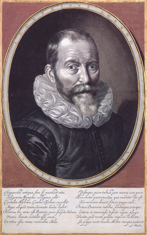
Willem Janszoon Blaeu (1571 - October 21, 1638)
At the same time that Jodocus Hondius Sr. was rising to prominence in Amsterdam, another man was building his own cartographic dynasty in the Low Countries. Willem Blaeu was born in 1571 to a herring merchant in Alkmaar. However, due to the young Blaeu’s special interest in scientific matters, the future mapmaker did not follow in his father’s footsteps. Instead, in 1595 Willem Blaeu traveled to Denmark to work with the famed astronomer, Tycho Brahe, where he learned the basic cosmography and mapmaking skills that would serve him for the rest of his life. By the turn of the century, Blaeu returned to Amsterdam and started his own business producing globes, instruments, and maps. In 1604 Blaeu’s first map appeared and by the end of the 1610s, Blaeu had established himself as one of Amsterdam’s leading printers and mapmakers. However, it wasn’t until 1630 that Blaeu began to produce atlases, an area of the market where the Hondius family held the monopoly. In 1632 Willem Blaeu was named as the official cartographer to the Vereenigde Oost-Indische Compagnie (V.O.C.), a position he had long coveted. Willem Blaeu died in October 1638 and left his growing business to his two sons, Joan and Cornelis Blaeu.
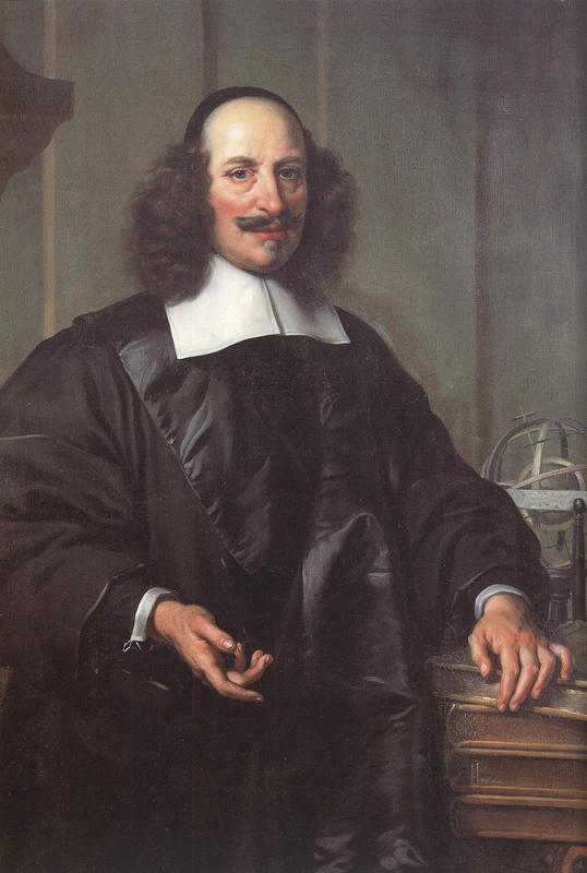
Joan Blaeu (23 September 1596 - 21 December 1673)
Born circa 1596 and circa 1610 respectively, Joan and Cornelis Blaeu took over their father’s business upon his death in 1638. In the same year Joan Blaeu also assumed his father’s position as the official cartographer to the V.O.C. The original appointment placed the Blaeu publishing house at the center of the mapmaking in Amsterdam, giving them “unprecedented power and influence” (Brotton, 278). The Blaeu brothers worked hard to maintain the firm’s position of prominence, but only five years later in 1642, Cornelius Blaeu died, leaving the publishing firm solely in the hands of Joan Blaeu. In 1648 Joan Blaeu was the first to publish a map depicting Nicolaus Copernicus’ theory of the Earth revolving around the sun, a heretical concept according to the Catholic Church. By 1662 Blaeu completed work on his magnum opus, the Atlas maior sive cosmographia Blaviana (The ‘Large Atlas or Blaeu’s Cosmography’). On February 23, 1672, a fire destroyed the Blaeu publishing house, a blow from which the firm never fully recovered. Joan Blaeu died the following year, leaving the business in the hands of his three sons, Willem (1635-1701), Pieter (1637-1706), and Joan II (1650-1712). While the business began to decline in the hands of his sons, the Blaeu control over the market truly came to an end in 1703 when the V.O.C. ceased publishing maps that bore the Blaeu family name.
Brotton, Jerry. A History of the World in Twelve Maps. London : Penguin Group, 2012.
Van der Krogt, Peter. Koeman’s Atlantes Neerlandici vol. II Utrecht: Hes & De Graaf Publishers, 2000.
A Cartographic Rivalry
As the V.O.C. expanded their reach around the globe, at home the demand for maps with the most accurate and up to date information was on the rise. The Hondius and Blaeu publishing houses led the charge to meet this rising demand. Both firms supplied the V.O.C. with maps, and yet it was not until the 1630's that the infamous rivalry, rooted in the feud between Willem Blaeu and Johannes Janssonius, formed between the Hondius and Blaeu families.
It is impossible to say exactly when their dispute began, but as early as 1608 Blaeu penned a letter of complaint to the States of Holland and West Friesland against Johannes Janssonius. His letter claimed a loss of income due to the fact that Janssonius’s 1611 world map bore a striking resemblance to Blaeu’s own 1605 world map (Brotton, 276). By 1618 Johannes Janssonius moved into the shop next door to Blaeu, and the feud only worsened with accusations on both sides of stolen information and copied works (van der Krogt, 25). In 17th century Amsterdam copyright did not exist the way it does now. Instead, the courts would issue a print privilege, which prohibited texts and prints from being copied for a specified number of years. A print privilege would be granted to a printer, which would protect their work until the expiration. In 1620 Johannes Janssonius copied Blaeu’s Light of Navigation, a marine atlas. Unfortunately for Blaeu, his print privilege for this work had recently expired. The only way that he could fight Janssonius’s plagiarism was to produce a new edition, which would have cost Blaeu greatly (Brotton, 276).
The latter half of 1629 brought Blaeu an unforeseen opportunity to strike back at Janssonius and his business partner, Henricus Hondius. Prior to this, the Hondius family held the monopoly on the production of atlases in Amsterdam. Jodocus Hondius Jr. and Henricus Hondius had continued the publication of their father’s famed Mercator-Hondius Atlas. However, during the 1620's the Hondius brothers fell out and went their separate ways, establishing competing businesses. Jodocus Hondius Jr. began work on a new atlas, complete with new copper plates never seen before. Hondius Jr.’s unexpected death in August 1629 granted Blaeu the opportunity to acquire the plates from Hondius’s widow, and providing Blaeu with an exclusive entre into the atlas market. The following year Blaeu’s Atlas Appendix was published with Hondius’s name replaced with Blaeu’s own and without any acknowledgement of where he had acquired the maps.
The acquisition of the plates was a striking blow for Henricus Hondius and Johannes Janssonius and sparked a bitter rivalry between the publishing houses that would last into the 18th century. Angered by the sale, on March 2, 1630, Henricus Hondius and Johannes Janssonius made a contract with the engravers, Salomon Rogiers and Evert Hamsersvelt, who worked with Hondius Jr. to engrave the original plates. The contract stipulated that “these 36 copper plates should be ready within eighteen months, should be accurate, finer and better than the maps given to the engravers” (Swaen.com). Throughout the latter half of the 17th century, the Hondius-Janssonius and Blaeu publishing houses were locked in a race to produce the most accurate and complete atlas. The competition to produce a multi-part atlas like this had never before been seen in the publishing world. Each family was investing extensive funds in commissioning new copper plates, trying to compile the newest maps into a complete atlas. It was a highly risky venture and costly investment for both firms. However, this race led to the creation of what many consider to be “the greatest and finest atlas ever published” in the form of the Blaeu Atlas Maior, composed of eleven volumes and 594 maps (Brotton, 265). It is even possible to question whether such a feat would have been created without the competition between the Hondius-Jansson and Blaeu publishing houses.
Brotton, Jerry. A History of the World in Twelve Maps. London : Penguin Group, 2012.
Swaen, Paulus. “A RARE COLLECTION OF MAPS PRODUCED AT THE BEGINNING OF THE RIVALRY BETWEEN THE HOUSES OF BLAEU AND HONDIUS.” Paulus Swaen Auction & Gallery, 18 Dec. 2018, www.swaen.com/jodocus-hondius-1629.php.
Van der Krogt, Peter. Koeman’s Atlantes Neerlandici vol. II Utrecht: Hes & De Graaf Publishers, 2000.
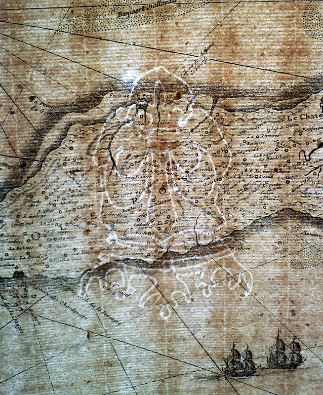
Making a map: Publishing, Printing, Papermaking

