Appendices of the British Isles and Northern Europe (Ms3)
The most elusive grouping of maps discovered during the course of the project was the Appendix Atlas of the British Isles and Northern Europe. In fact, it was not until our meeting with U-M Library’s former paper conservator, Cathleen Baker, that the fourth atlas came to our attention. The Appendix Atlas of the British Isles and Northern Europe, or more commonly referred to as “Manuscript Style 3” or “Ms3,” is a composite atlas containing approximately 23 maps. Given the atlas’s geographic focus and the consistent design throughout, it became apparent that the atlas was assembled to mimic the style of an appendix atlas by the Hondius or Janssonius firms. With this in mind, the Clark Library created the title, Appendix Atlas of the British Isles and Northern Europe, to reflect this unique collation. Nonetheless, Ms3 is actually a composite atlas, likely assembled at the request of a patron with the publisher and publication date unknown.
Certain physical characteristics, such as manuscript numbers, guards, and red sprinkles, can be found across the maps, indicating that they were all bound together for a time. Each sheet in the atlas has a manuscript number written in the top right corner of the verso, along with the subject of the map written in French. These manuscript numbers allow the maps to be arranged into the order in which they were likely bound. At the same time a closer examination reveals the same guards, strips of paper glued to the verso that is then sewn into the binding rather than the map itself, were used throughout the volume. Similarly, corresponding wormholes can be seen across several of the map sheets, demonstrating that they were stored together at the time. The final clue that indicates that these maps were all bound at one point during their lifetime is the evidence of red sprinkles visible along the fore-edge, head, and tail of the volume. When a book or atlas was bound, the fore-edge, head and tail might be decorated with red sprinkles or guilding. Such a decoration is added by firmly clamping the book shut, placing it on the spine and dusting the edges with the red dye. However, if the volume is not securely clamped shut, the red sprinkles will slip between the pages and become visible on the edges of the map sheets. It was thanks to Cathleen Baker that these particular physical characteristics became apparent to us. These red sprinkles can be found on many of the maps found in this atlas.
While many of the maps from the Vignaud Map Collection can be identified using Peter van der Korgt’s Koeman’s Atlantes Neerlandici, a total of 16 maps from this set do not match any listings in the authoritative bibliography, with 11 of these maps differing only slightly from those described in the work. This would suggest that the maps are previously unknown states, or variants of these maps. We have not found any additional mention of these unknown variants in other resources.
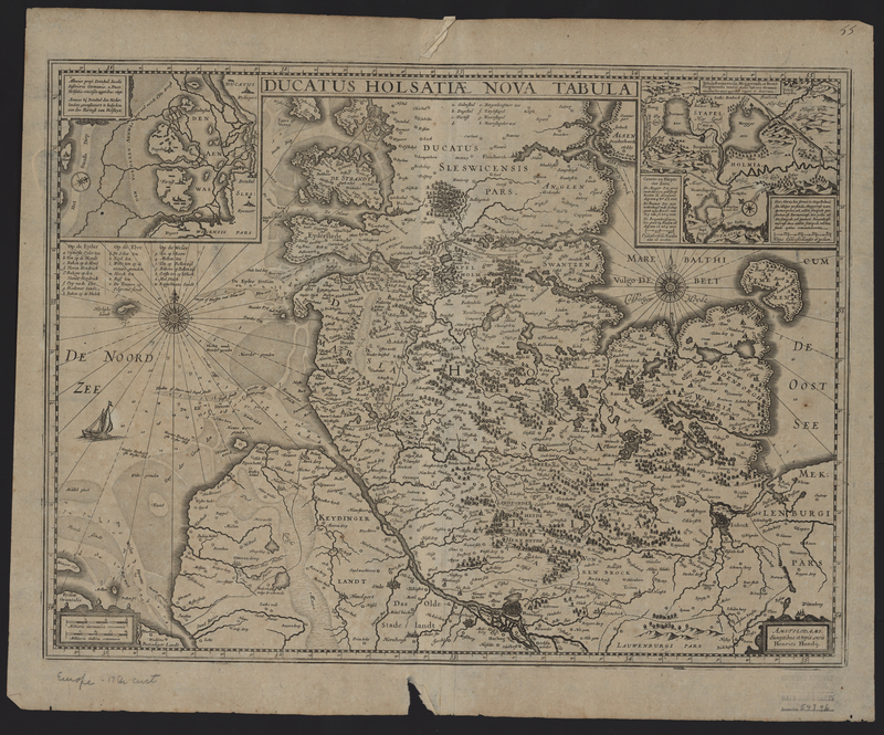
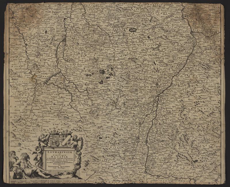
Ducatus Holsatiae Nova tabula
Ducatus Holsatiae Nova Tabula (Holstein, Germany) was published by Henricus Hondius multiple times between 1630 and 1633 and included in several different atlases. Unlike other maps in this volume the Ducatus Holsatiae Nova Tabula has a manuscript "55" written in the upper right corner of the recto. However, there are also three additional manuscript numbers on the verso. The "8" and "33" are crossed out, suggesting that this particular state was included in other bound volumes, but the remaining manuscript "11" fits the sequence of the other maps in the composite atlas. An additional feature of these maps is the presence of a description written in French of the subject of the map. In this case the verso reads "Duche d'Olsace."
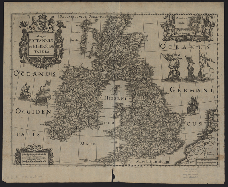
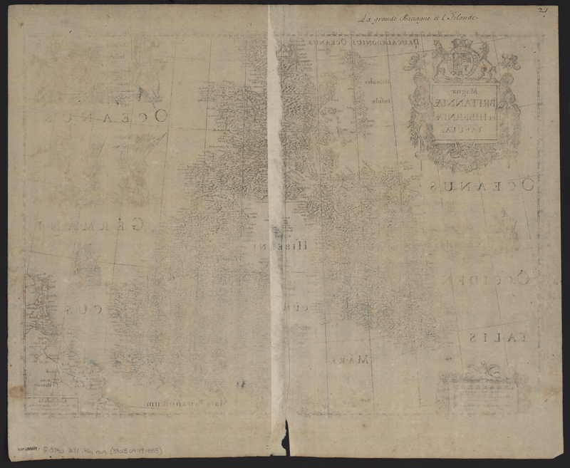
Magnae Britanniae et Hiberniae Tabula
The Magnae Britanniae et Hiberniae Tabula (United Kingdom) was published by Henricus Hondius in 1631 in his Atlantis Maioris Appendix. As this is the only known publication of this particular state, the inclusion of it in this group supports that the Appendices of the British Isles and Northern Europe is a composite atlas, compiled at the request of a patron or at a later date. In accordance with the other maps found in this atlas, the map features the script on the verso "La grande Bretaigne et l'Irelande."
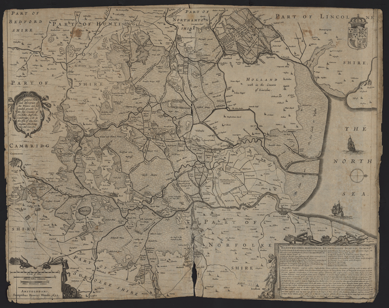
A General Plott and Description of the Fennes
The A General Plott and Description of the Fennes and Surrounded Grounds in the Sixe Counties of Norfolke, Suffolke, Cambridge, with in the Isle of Ely, Huntington, Northampton and Lincolne, etc. (United Kingdom) was published by Henricus Hondius in two known atlases in 1631 and 1637. This particular state includes an inscription within the scale cartouche stating that Hondius originally commissioned the engraving of the plate in 1632. With this date, we know that the composite atlas was compiled after 1632, but it is impossible to provide a definite date.
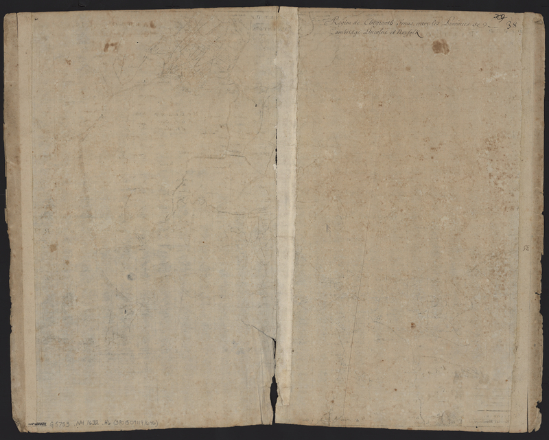
As with the other maps found in this atlas, the verso of the map has a series of manuscript numbers written in the top right corner of the verso, including a crossed off "31" and "9" and the final number "38" which matches the sequence determined by the other maps in the composite atlas. Another feature that matches the other maps in the atlas is the prescence of the manuscript description of the map subject, reading "Region de Thegreath Fenus, entre les Provinces de Cambridge Lincolne et Norfolk."
Atlantis Maioris Appendix of 1630 (MS2)
Orphan Maps