Artistic Marks from the Medieval World
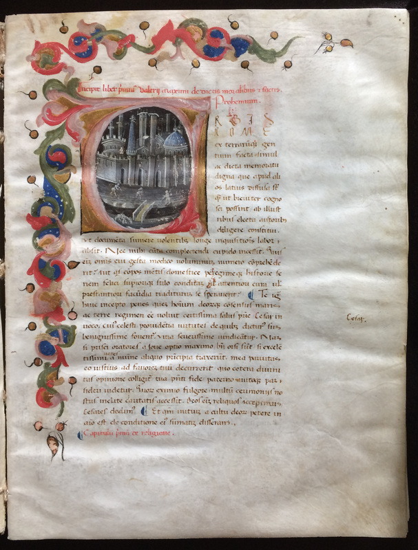
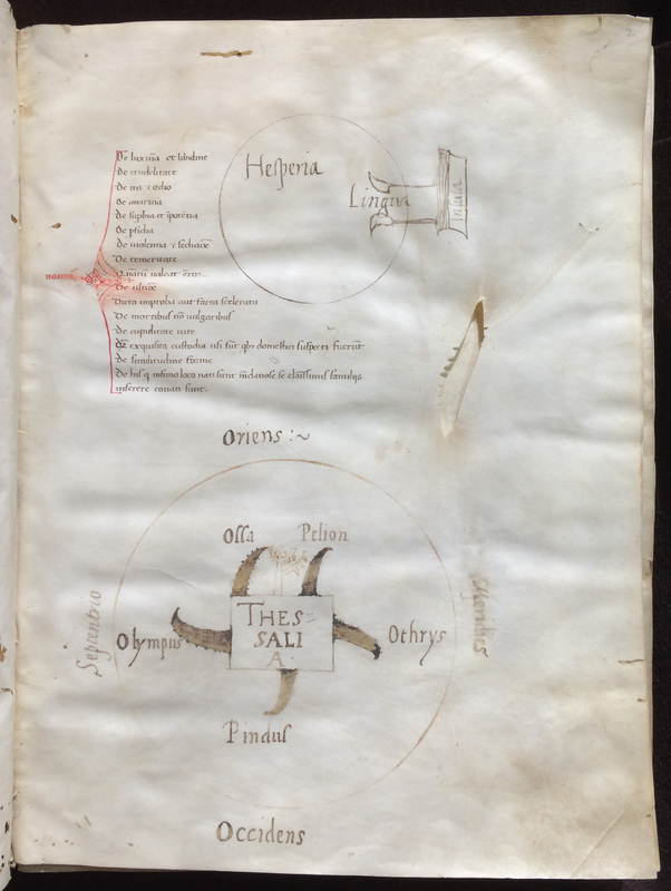
In the preliminary pages of this fifteenth-century Italian manuscript containing Valerius Maximus' Memorable Deeds and Sayings, the scribe, or perhaps a reader, has drawn a series of maps of the known world, or sections of it, as it was conceived throughout the Middle Ages. Contrasting with the quasi-realistic representation of Rome encapsulated in the decorated initial "U", these maps, however, suggest a schematic, almost abstract, representation of the world. Interestingly, the drawings of this manuscript seem to be playful additions of the scribe: being randomly located within the table of contents and a preliminary blank page, they have a marginal life of their own, detached from the content of Valerius Maximus' text.
On the lower half of the page displayed below we can see a drawing of a schematic representation of a belt of mountains encircling the plain of Thessaly (central Greece): Olympus, Ossa, Pelion, Orthys, and Pindus. These mountains are inside a circle marked with the four cardinal directions: Septentrio (north), Oriens (East), Meridies (south), and Occidens (west). Considering that Valerius Maximus does not describe this region of Greece in his Memorable Deeds and Sayings, we may ask: why did the scribe include it in this manuscript? Was it a playful addition, perhaps by a later reader day-dreaming about the extraordinary myths embedded in these mountains? The unfinished doodle-like nature of the other drawing above suggests this hypothesis.
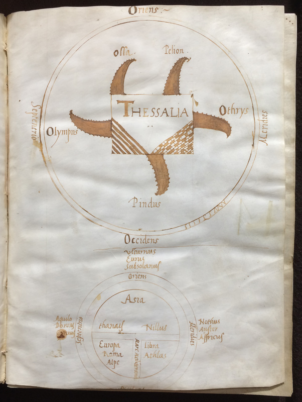
We see again the same representation of Thessaly on folio 4r. Interestingly, this schematic map appears within the text of some medieval manuscripts of Lucanus' Bellum civile as evidenced, for instance, by British Library Harley 2728 (11th c.) and Beinecke Library Ms 332 (13th c.). Next, in the lower half of the same page is a typical T-O map: a depiction of the earth as a circle divided by a horizontal lines across an inner circumference, with the lower half divided by vertical lines forming a "T" in the circle. The vertical stroke of the "T" is the Mare Mediterraneum; the left section of the horizontal stroke is the river Thanais; and the right one is the river Nillus. The circle includes the three known continents: Asia, Europa, and Africa. Lastly, we can see a list of winds ascribed to their respective compass points, except for Occidens since the lower edge has been trimmed: Aquilo, Boreas and Circius; Vulturnus, Eurus, and Subsolanus; Nothus, Auster, and Affricus.
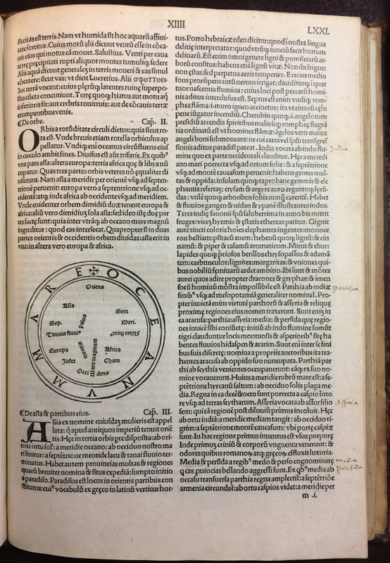
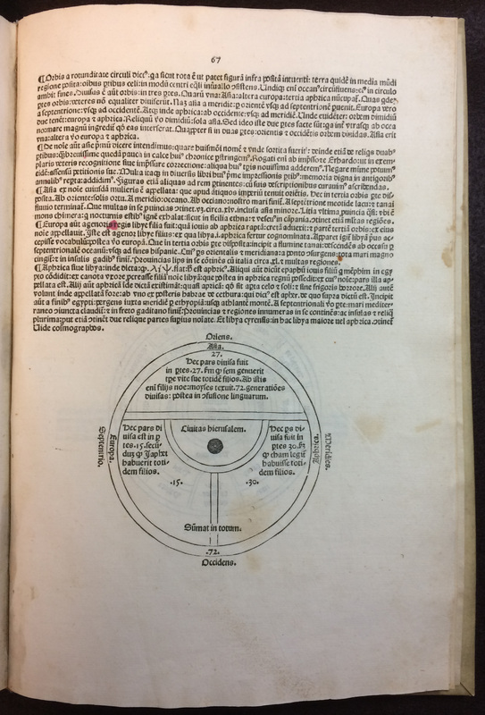
T-O maps represent the known world according to Isidore of Seville's description in Book 14 of his Etymologies. Called orbis because of its likeness to the roundness of the circle or that of the wheel, the known world, argues Isidore, consists of the three known continents (Asia, Europa, and Africa) encircled by an Oceanus flowing around them. Isidore also depicts each of the continents as being populated by the sons of Noah (Shem, Ham and Japheth) as we can see in the following two early printed editions.
Marks of Correction: How to fix a Manuscript Line

