The Founding (1817-1837)
History of U-M in Detroit
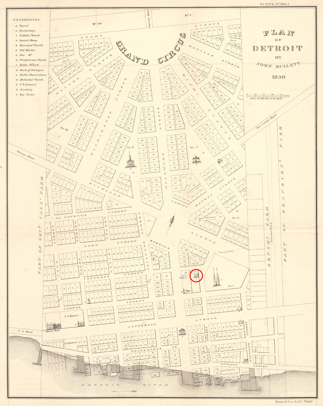
The Catholepoistemiad, the school that became the University of Michigan, was created in Detroit in 1817. Since 1805, Father Gabriel Richard had been trying to organize primary education within the Territory of Michigan. Governor Lewis Cass appointed territorial judge Augustus Woodward to create the first school system, and Woodward, along with the Reverend John Monteith and Fr. Richard, created the Catholepoistemiad. On August 26, 1817, it was officially established by the territorial legislature and was one of the first publicly funded school systems in the United States. It served the main territorial settlements of Detroit, Frenchtown, Mackinac Island, and Sault Ste. Marie. The first school building was located on Bates Street, between Congress and Larned (see the image below). The new school was based on Napoleon Bonaparte’s newly created University of France, which was organized with the university at the center of a statewide system of primary, secondary and college education.
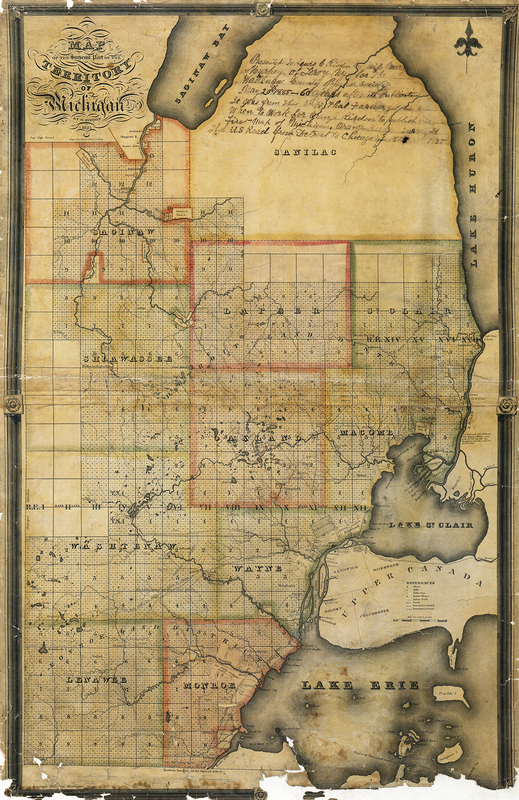
In that same year, the Treaty of Fort Meigs was signed between the United States and the Ojibwe, Odawa, and Bodewadmi tribes. Under the treaty, 1,920 acres of land were granted by the tribes for the use of the newly established college in Detroit. One of the tribes’ provisions for granting the land in the treaty was the belief that, “they may wish some of their children hereafter educated.” The $5,000 proceeds from the eventual sale of a portion of the land in 1834 were placed in a general fund and were central in the early functioning of the university, including the move to Ann Arbor in 1837.
The Move to Ann Arbor & the 1840 Plan